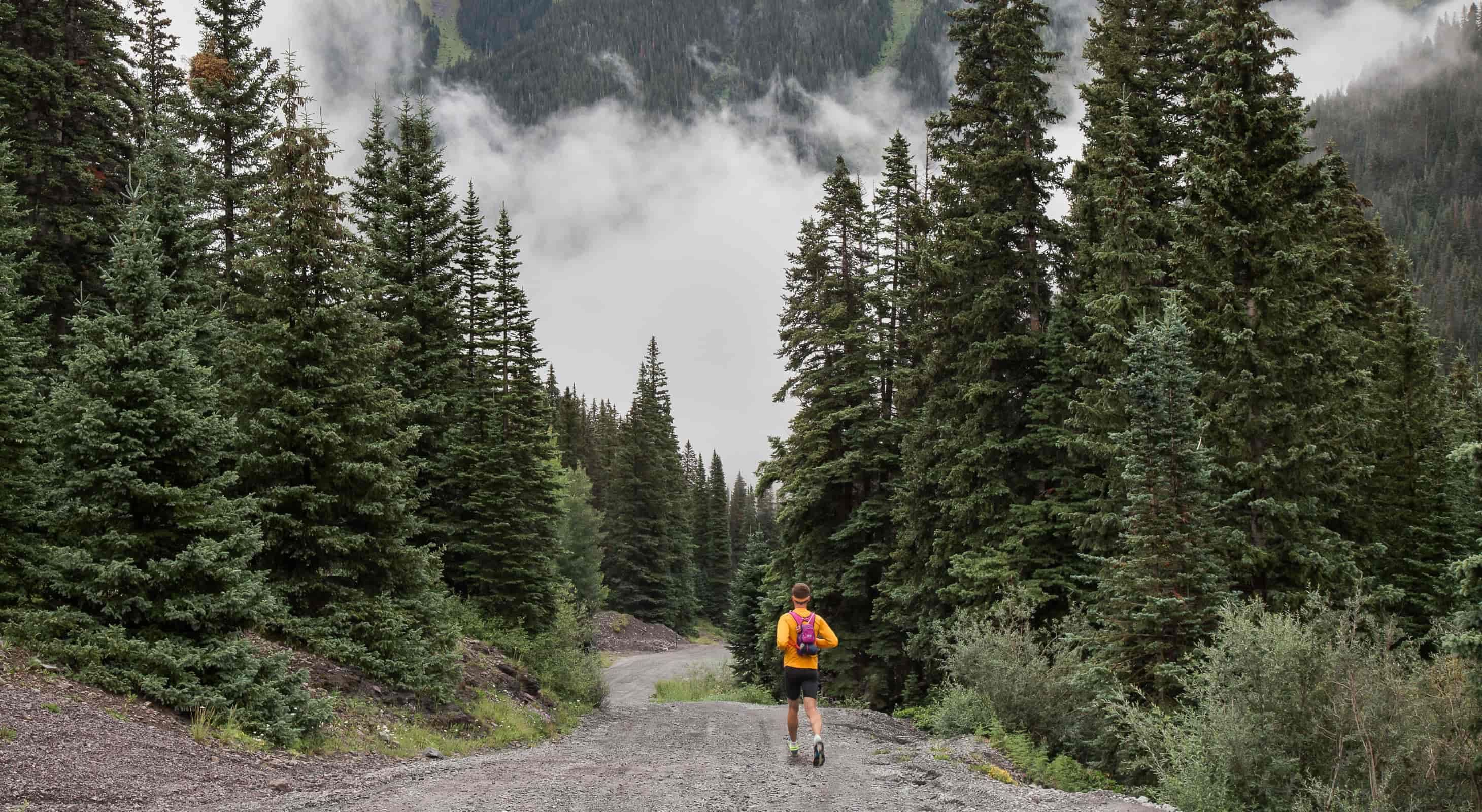
Singletrack winding through the forest, unspoiled surroundings and that feeling of being free on a trail – that’s what trail running is all about. There is something simple and pure about lacing up your shoes and grabbing a water bottle – no other equipment required as the Rocky Mountains are your playground.
Close to Wild Horse Inn there are hundreds of miles of trails suitable for running. The trails here are one of the main reasons Inn owners John and Chris moved to the area, and they are happy to share their trail knowledge with you during your stay. We’ve mapped out a few favorites here, but ask us if you want even more trails to explore….there are so many!
NORTHWEST PASSAGE/TIPPERARY CREEK/FLUME
About 14 Miles
From Wild Horse Inn, take CR 83 to Hwy 40 and head into Fraser. At the Conoco Station in Fraser, turn right, proceed across the railroad tracks and immediately make a left to parallel the tracks. The road turns into CR 73, Saint Louis Creek Road. Pass the rodeo grounds and continue to the first major forest service sign on your right, where there is a parking turnout on both sides of the road. If you get to the sign for St. Louis Creek Campground, you’ve gone too far.
Park at the turnout and look for the trail sign for Northwest Passage on the north side of the road. The first 1.5 stretch of trail is a nice warmup, ending at the intersection with CR 50. Bear left on 50 and run approximately 2.5 miles on the dirt road, passing Crooked Creek Ranch along the way. Turn left onto the Tipperary Creek Trail and begin a steady climb through trees and meadows. The climb is never truly steep, but take your time as it is steady and long. Bypass Backscratch Trail on your right near the top and continue over the river and to the intersection with Spruce Creek Trail. The descent down Spruce Creek is a welcome reward after the climb. Be mindful of the loose sections – ankle twisters abound. At the intersection with CR 73, the dirt road, turn right then make a left beyond the parking area onto FS 159. About ¼ mile up the road, turn left onto Flume Trail. Flume continues downward approximately 2.8 miles to meet Chainsaw. Turn left at this intersection, down the hill, across the river, and bear left then right onto the double track. Turn right at the forest service sign and .8 miles later you’ll emerge from the forest back to where you started at the top of Northwest Passage.
Chris’s Take:
“This is one of the most satisfying mid-distance trail runs in the area. Enjoy!”
CREEKSIDE/FLUME LOOP
5.3 miles
From Wild Horse Inn, take CR 83 to Hwy 40 and head into Fraser. At the Conoco Station in Fraser, turn right, proceed across the railroad tracks and immediately make a left to parallel the tracks. The road turns into CR 73, Saint Louis Creek Road. Follow this road to the sign for Saint Louis Creek Campground – make a left here and park in the obvious lot before you reach the actual campground.
This loop is an area classic. The terrain is moderate, semi-technical and totally scenic.
The trailhead for Creekside is on the north side of the parking area. Creekside begins as a double track that winds past the campground and through the forest, becoming a single track at mile .08. Creekside parallels the St. Louis Creek, taking in willows, wildflowers and sagebrush along the way. Creekside ends at a dirt road, FS 159. Turn left here and go about ¼ mile where you will see the trailhead sign for Flume Trail to your left.
The Flume trail section is windy, fast and loamy. Look for columbines and wild geraniums along the cooler part of this sweet singletrack. Don’t miss the bench above the river where you can stretch and catch amazing views of Byers Peak. After the bench you’ll come to the intersection with Chainsaw; turn left and go down the hill, across the river and bear left, then right, staying on the double track to return to the parking lot.
Chris’ Take:
“No matter how many times I run this loop I never get tired of it. Because it gets good use year round, it is also a favorite of mine for winter runs.”
PHASES/HURD PEAK LOOP
Approximately 10 miles
Note: This trail is not on the map. Ask John or Chris for more information.
From the Inn, take CR 83 toward Hwy 40. Take the sweeping right hand bend before you reach the highway. Continue approximately ½ mile to the end of the pavement where you will turn left onto Strawberry Road. Park at the bottom of the road.
Start your run by climbing Strawberry Road for a just under a mile. Turn right onto Hurd Peak Road, just beyond a large parking turnout. Follow Hurd Peak Road as you climb to the top, staying on the main road and bypassing all other unmarked roads. This climb is steady and challenging, but not technical so you can take in the amazing views of the valley and the mountains as you make you way up.
The climb ends at a hunter’s camp. Just beyond the rock fire ring turn left onto the single track trail. This is an unmarked single track, and is known locally as Phase .75. Run until you come to a road crossing, and continue down the single track after crossing the road. You will cross one more road, and then you’ll be on the final section to the bottom. You will exit onto Strawberry Road and make a left down the hill. Retrace your steps to your car.
Chris’ Take:
“The views make the climb worth the effort – and look for animal tracks – they are everywhere!”
HIGH LONESOME TRAIL
Approximately 14 miles out and back
From the Inn, take 83 toward Hwy 40. Take the sweeping right hand curve before the highway and the road is now 84. Take 84 approximately 11 miles, passing Meadowcreek Resevoir, to Junco Lake Trailhead. Park here and start your run.
Run approximately 1/8 mile up Junco Lake Trail to a clearly marked sign for High Lonesome Trail. Turn right onto the trail here and just follow the trail along 7 miles to the sign for Devil’s Thumb Park. Most of this run is moderately rolling and totally enjoyable with big views and lush forests, and just about zero company.
If you want to run longer, turn left when you get to Devil’s Thumb Park and go as far as you like up the trail to Devil’s Thumb which sits on the Continental Divide. For a shorter run, just turn around when you feel like it and soak your feet in the river near the Junco Lake Trailhead when you finish.
Chris’ Take:
“This whole run is at higher altitude, so make sure you take that into account – bring extra water, bring a light shell, and wear sunscreen.”

